On August 26, the fragile equilibrium of the Himalayas shattered near the border between Nepal and Tibet, unleashing a catastrophic cascade of rock and ice that has left over 1,300 people dead and thousands more missing. The disaster, triggered by the sudden collapse of a mountain side, highlights a terrifying global reality: as climate change accelerates the melting of the world’s icy landscapes, high-altitude regions are facing unprecedented geological hazards that are as destructive as they are unpredictable.
The scale of the event is almost incomprehensible. Approximately seven billion cubic feet of glacial ice and rock—an icy volume capable of filling 100 football stadiums—plunged roughly a mile vertically into the river valley below. The resulting impact displaced a massive wall of muddy water that tore through the downstream valley at speeds reaching 100 miles per hour. Entire villages were obliterated within minutes, catching residents and local authorities entirely off guard and leaving a trail of profound devastation that spans dozens of miles.
The Mechanics of Catastrophe: Why Melting Ice Destabilizes Slopes
To understand how a mountain can seemingly disintegrate overnight, scientists point to the complex physical changes occurring within the world’s shrinking cryosphere. Global glaciers have diminished by approximately one-fifth over the past century, with projections indicating they will lose at least another quarter of their mass by the year 2100. Each fraction of a degree in global temperature rise accelerates this decline, stripping hundreds of billions of tons of ice from mountain ranges annually.
This loss of ice is not merely a visual change; it acts as a structural failure for the entire ecosystem of high-altitude ranges. Glaciers traditionally function as heavy, cold buttresses supporting the steep flanks of mountains. As these massive blocks of ice retreat, they leave behind newly exposed, highly unstable deposits of silt, loose rock, and debris.
Furthermore, high-altitude soils and rock faces are frequently bound together by permafrost—a permanently frozen layer that acts as a natural cement, locking slopes into place. When atmospheric temperatures rise, this permafrost thaws, weakening the structural integrity of the mountain. Simultaneously, glacial meltwater infiltrates microscopic cracks in the bedrock, exerting hydraulic pressure that further destabilizes the geological foundation.
These compounding processes create a high-risk environment prone to sudden, catastrophic failures. Similar mechanics were observed last summer in Alaska, where a massive mountain slope collapse triggered a towering 1,500-foot megatsunami in Tracy Arm. In Nepal, these exact vulnerabilities converged, transforming a mountainside into a projectile of unprecedented destructive force.
A Global Crisis: From the Alps to the Andes
While the tragedy in Nepal underscores the extreme vulnerability of the Himalayas, the phenomenon of glacial and permafrost collapse is a global crisis affecting diverse mountain ranges.
In Juneau, Alaska, the retreat of the Mendenhall Glacier has created annual flooding crises since 2011. A nearby glacial-dammed valley known as Suicide Basin regularly accumulates trapped rainwater and meltwater. When the water volume reaches a critical threshold, the ice barrier lifts, releasing billions of gallons of water in a sudden torrent. However, unlike the disaster in Nepal, Juneau’s annual floods have never claimed a life. This safety record is maintained through rigorous, round-the-clock monitoring. Eran Hood, a hydrologist and environmental science professor at the University of Alaska Southeast, notes that local authorities utilize advanced technological infrastructure—including automated cellular alert networks, live surveillance cameras, precision laser water-level sensors, and periodic drone mapping—to track the basin’s volume and provide early evacuation warnings.
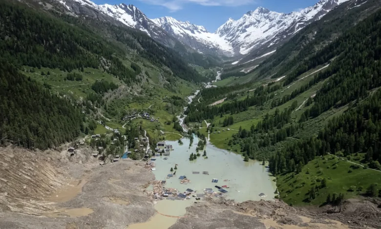
Similar proactive engineering has yielded success in South America. For decades, the Peruvian government has actively drained high-risk glacial lakes across the Andes, a massive hazard-mitigation effort that environmental studies professor Mark Carey notes has "no doubt saved tens of thousands of lives." In Europe, authorities demonstrated the life-saving potential of timely intervention last summer when Swiss officials successfully evacuated 300 residents from the Alpine village of Blatten just days before a destabilized glacier collapsed, burying the settlement in an avalanche of ice and debris.
The Himalayan Blind Spot: Why Early Warning Fails in Nepal
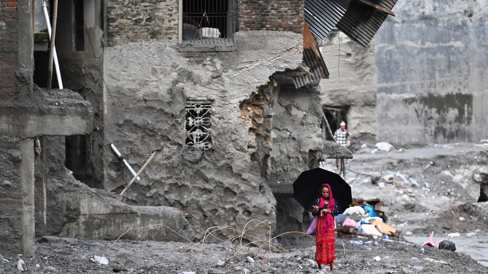
Despite these international success stories, replicating such comprehensive monitoring in the Himalayas remains an immense logistical challenge. While certain high-risk rivers and lakes in the region are outfitted with basic water-level sensors, there is currently no comprehensive, continuous regional system capable of detecting the sudden, silent destabilization of remote mountain slopes.
The sheer geography of the Himalayas—vast, rugged, and characterized by thousands of glaciers spread across isolated, difficult-to-access terrain—makes exhaustive, ground-based surveillance nearly impossible. Resources in the region are severely constrained, leaving communities downstream perpetually vulnerable to rapid-onset events that materialize without warning.
As Mark Carey of the University of Oregon explains, glacial loss destabilizes mountain slopes in ways that are deeply far-reaching, unpredictable, and catastrophic. When dealing with geological failures that execute instantaneously and rush downslope at hurricane speeds, establishing effective localized early warning systems becomes an extraordinary scientific hurdle.
New Frontiers in Detection: Technology Offers a Glimmer of Hope
In the wake of the Nepal disaster, researchers and technologists are racing to adapt cutting-edge tools to bridge the dangerous gaps in global hazard monitoring.
One promising avenue involves the repurposing of seismic networks. In urban centers like Mexico City, dense arrays of seismometers provide critical seconds of early warning before destructive earthquake waves arrive. Scientists are now investigating whether these same networks can detect the low-frequency vibrations generated by catastrophic landslides and glacial outbursts. Notably, the mountain collapse in Nepal registered seismic waves equivalent to a 5.2 magnitude earthquake—vibrations that traveled as far away as Alaska.
Where warning times have been even slightly extended, the results have proven transformative. During the recent disaster in Nepal, an alert reached a downstream school just minutes before the muddy torrent arrived. Thanks to the swift actions of the principal, 900 students were successfully evacuated to higher ground before the school was completely submerged.
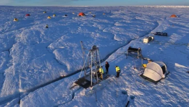
In addition to seismic monitoring, glaciologists are experimenting with innovative in-situ technology. At research sites in Switzerland, scientists have laid fiber-optic cables directly across endangered glaciers. These cables can detect "icequakes"—minuscule fractures within the ice mass that generate micro-seismic signals, offering researchers vital clues regarding shifts in structural stability well before a collapse occurs.
Furthermore, space-based observation has taken a monumental leap forward. A newly operational satellite developed jointly by the space agencies of the United States and India, known as NISAR (NASA-ISRO Synthetic Aperture Radar), was specifically engineered to track subtle shifts in Earth’s surface. Unlike older satellite technology, NISAR can penetrate heavy cloud cover and capture high-resolution imagery of snow and ice dynamics. Retrospective analysis of data captured by NISAR revealed that the satellite had indeed recorded distinct slumping and movement on the ill-fated Nepal mountain slope several weeks prior to its catastrophic collapse.
The Tipping Point of High-Altitude Geohazards
Despite the rapid evolution of remote sensing, seismic analysis, and satellite technology, experts caution that technology alone cannot completely eliminate the risks posed by a warming planet.
Dan McGrath, a glaciologist and associate professor at Colorado State University, emphasizes that there is no singular silver bullet capable of halting these natural disasters. Mountain ranges across the globe are rapidly approaching dangerous thermal tipping points. The physical state of high-altitude ice and permafrost is fundamentally binary: it is either frozen and stable, or it thaws and fails.
As global greenhouse gas emissions continue to push atmospheric temperatures upward, the relentless thawing of permafrost and retreat of glaciers will guarantee an increasing frequency of catastrophic mountain collapses. For the millions of people living downstream from the world’s dwindling ice sheets, the disaster in Nepal serves as a grim warning—highlighting an urgent need to pair cutting-edge scientific surveillance with robust, climate-resilient infrastructure before the next mountain gives way.