The Ultimate Guide to Urban Trail Hiking in Europe: Merging Capital City Life with Wilderness Access

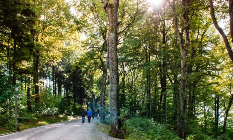
Urban centers across Europe are increasingly defined not just by their architectural landmarks, cultural institutions, and bustling culinary scenes, but by their remarkably seamless integration with expansive wilderness and trail networks. In recent years, urban planners, environmental ministries, and tourism boards have observed a significant surge in demand for outdoor recreation that requires zero-long-distance transit to initiate. Capital cities from Scandinavia to the Mediterranean are proving that high-density urban living does not necessitate a divorce from nature. Instead, municipal transit systems—ranging from subway lines and commuter trains to historic funiculars and cable cars—now double as trailheads, depositing commuters and travelers alike into dense ancient forests, volcanic craters, alpine ridges, and coastal national parks within minutes. This evolving paradigm of accessibility is reshaping how urban populations engage with physical fitness, weekend tourism, and environmental conservation.
Stockholm, Sweden: The Sörmland Trail
The geographical interplay between metropolitan Stockholm and the surrounding Swedish wilderness represents one of the most successful models of urban-adjacent trail engineering in Europe. The Sörmlandsleden (Sörmland Trail), an extensive network spanning over 600 miles, begins its vast journey just steps from the Björkhagen metro station within the Swedish capital. Established to preserve regional heritage and promote non-motorized outdoor recreation, the trail provides an immediate transition from urban infrastructure into a protected landscape of mossy forest valleys, glacial lakes, and coastal archipelagos.
Municipal and regional authorities maintain the trail through a collaborative framework involving local outdoor organizations, ensuring that paths remain cleared and ecological guidelines are strictly enforced. The trail’s modular design—broken into manageable segments ranging from one to 13 miles—allows for flexible day trips, while designated shelters and permissive camping laws under the Swedish Allemansrätten (Right to Public Access) encourage overnight wilderness immersion. Environmental data from regional tourism boards indicates a steady 15 percent year-on-year increase in public transit-assisted trailhead entries, underscoring the growing public preference for car-free wilderness access.
Zurich, Switzerland: The Planet Trail
Integrating educational geography with accessible alpine terrain, the Planet Trail (Planetetenweg) near Zurich demonstrates how municipalities can transform regional transit routes into immersive public experiences. Spanning the ridge between the Uetliberg mountain and the Felsenegg vantage point, the two-hour route scales geographic recreation with astronomical scale. Along the path, hikers encounter meticulously scaled models of the solar system’s eight planets and Pluto.
The engineering metric governing the trail—where every single meter walked represents one million kilometers of actual space—converts a standard leisure walk into an empirical visualization of cosmic scale. Accessible via a short suburban train ride from Zurich’s central station followed by a historic cog railway, the route serves as a case study in low-impact tourism development. Regional authorities emphasize that the trail requires minimal physical exertion compared to high-altitude alpine ascents, making it a vital infrastructural asset for multigenerational demographic engagement and school-group educational programming.
Edinburgh, Scotland: Arthur’s Seat
Rising dramatically behind the medieval corridors of the Scottish capital, Arthur’s Seat within Holyrood Park offers a striking geological contrast to the urban density of Edinburgh. Preserved under the management of Historic Environment Scotland, the extinct volcano stands 823 feet above sea level, anchoring a landscape that features prehistoric hill forts dating back over two thousand years.
The site serves as a prime example of urban park management balancing intense public foot traffic with archaeological and ecological preservation. Geologists and park rangers regularly monitor trail erosion along the popular Salisbury Crags route, implementing sustainable paving and drainage techniques to protect the volcanic bedrock. Urban planning analysts note that the proximity of such rugged terrain to a major financial and cultural capital enhances the city’s liveability index, offering residents immediate access to cardiovascular elevation training and panoramic views without requiring motorized transit.
Athens, Greece: Mount Parnitha National Park
Located a mere 30 minutes north of downtown Athens by motor vehicle, Mount Parnitha represents the zenith of the Attica region’s topographical relief. Rising as the highest mountain range in the immediate vicinity of the Greek capital, Parnitha holds deep historical and mythological significance, traditionally celebrated as the domain of the god Pan. Today, the mountain operates as a strictly protected national park administered by the Greek Ministry of Environment and Energy.
The park features a comprehensive network of 12 marked trails winding through dense fir and pine forests, past active karst cave systems adorned with stalagmites and stalactites, and alongside ancient Byzantine fortresses. Strategic investments in the park’s infrastructure include the maintenance of two prominent mountain refuges, Bafi and Flambouri, which provide overnight lodging, nutritional support, and emergency shelter for hikers. Following devastating wildfires in previous decades, local reforestation initiatives and volunteer-led trail restoration programs have successfully rehabilitated large sections of the park, reinforcing its status as an essential ecological lung and recreational sanctuary for the millions of residents inhabiting the Athenian basin.
Dublin Mountains Way, Ireland
Extending across the southern perimeter of the Irish capital, the Dublin Mountains Way provides a 25-mile long-distance traversing route that connects suburban Shankill to the expansive residential district of Tallaght. Developed and maintained by the Dublin Mountains Partnership—a collaborative body comprising local authorities, state agencies, and recreational clubs—the route was designed to formalize and protect ancient pathways, forest tracks, and heritage roads.
While completing the full trajectory requires approximately 12 hours of sustained trekking, the trail is officially partitioned into three distinct operational sections: Shankill to Three Rock Mountain, Three Rock to the historic Hell Fire Club, and the final stretch toward Tallaght. This modular configuration allows commuters using Dublin’s extensive bus and suburban rail networks to access targeted day hikes. Conservationists highlight the route as a vital corridor for biodiversity protection, linking fragmented habitats while managing visitor impact on sensitive upland environments, particularly around the high-altitude viewpoint of Fairy Castle.
Zagreb, Croatia: Mount Medvednica Nature Park
Overlooking the Croatian capital from the north, Mount Medvednica is anchored by a protected nature park that exemplifies successful municipal-wilderness integration. Accessible directly via Zagreb’s public tram and bus networks, the mountain acts as an immediate recreational escape for the city’s population.
The park’s administration oversees dozens of meticulously marked trails that intersect with historical landmarks, including medieval ruins, subterranean mines, natural springs, and traditional mountain lodges that serve locally sourced culinary specialties. Among the infrastructure, the Leustek trail offers a gentle, low-impact grade through dense beech and oak forests, culminating near Sljeme, the mountain’s highest summit at over 3,000 feet. Environmental impact assessments consistently rate Medvednica as a benchmark for balancing high-volume weekend tourism with the preservation of endangered flora and fauna within a heavily populated Central European region.
Oslo, Norway: Barlindåsen Ridge
Norway’s capital is globally recognized for its stringent commitment to urban green boundaries, and the Barlindåsen Ridge serves as a prime exemplar of this ethos. Located approximately 30 minutes north of Oslo’s central business district via the Sandermosen train station, the trail offers an efficient, moderate-difficulty loop that rewards hikers with expansive vistas over the forested Marka region encircling the city.
The 3.5-mile trail is designed to accommodate moderate physical conditioning, typically requiring around two hours of active movement. Forestry management agencies in Oslo utilize sustainable trail-building practices to prevent soil compaction and root damage, preserving the delicate taiga ecosystem. Furthermore, municipal guidelines encourage foraging within designated public lands, leading to seasonal influxes of hikers harvesting wild blueberries during the peak summer months, thereby merging recreational trekking with traditional Norwegian outdoor culture (friluftsliv).
Innsbruck, Austria: Goetheweg and the Nordkette
Innsbruck offers arguably the most dramatic urban-to-alpine transition in Europe, facilitated by heavy investment in alpine engineering. Through the Nordkettenbahn cable car system, travelers can depart from the historic Altstadt (Old Town) and ascend over 7,000 feet into high-altitude terrain in less than 20 minutes. The journey deposits visitors at Hafelekarspitze, the starting point of the renowned Goetheweg ridge trail.
Traversing the rugged alpine ridge of the Karwendel mountain range before descending through alpine meadows toward traditional huts such as the Arzler Alm, the trail presents severe physical demands, dropping over 5,000 feet back to the city floor. Mountain rescue teams and alpine tourism associations strongly advocate for the use of technical equipment, such as trekking poles, to mitigate the joint strain associated with the steep descent. Economic data from the Tyrol region confirms that such infrastructure significantly bolsters shoulder-season tourism, driving sustainable economic revenue for local hospitality operators while maintaining strict environmental protections within the Karwendel Nature Park.
Lisbon, Portugal: Peninha Trail and Sintra-Cascais Natural Park
Situated 40 minutes by commuter train from downtown Lisbon, the forested hills of the Sintra-Cascais Natural Park rise abruptly from the Atlantic coastal fog, offering a complex network of historical and ecological trails. The Peninha Trail system connects urban transit terminals with monumental heritage sites, including the Moorish Castelo dos Mouros and the chromatic towers of the Pena Palace.
The route climbs to Cruz Alta, the highest point of the Sintra range at 1,542 feet, before extending westward toward the historic Peninha chapel and terminating at Cabo da Roca, the westernmost extremity of continental Europe. Managing the heavy foot traffic across this 10-mile full-day trek requires strict cooperation between municipal authorities, the Institute for Nature Conservation and Forests (ICNF), and regional rail operators. Park administrators continuously update trail markers, construct boardwalks over fragile peatlands, and regulate visitor access to prevent erosion on the steep, weather-beaten Atlantic slopes, ensuring the long-term preservation of one of Portugal’s most culturally and ecologically significant landscapes.