
The Evolution of Wrist-Based Navigation: How Offline Maps Moved from Luxury Fitness Wearables to Mid-Range and Budget Sports Watches

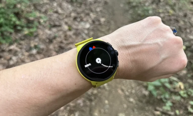
For years, integrated wrist-based cartography was considered the exclusive domain of high-end mountaineering and ultra-running gear. Athletes seeking detailed, standalone offline maps directly on their watch faces were forced to invest heavily, often spending upwards of $1,000 on flagship models designed for extreme expeditions. However, a significant shift in the sports technology market has altered this landscape. Today, manufacturers of fitness tracking and running wearables have successfully democratized geographic data, introducing full-scale offline mapping capabilities to mid-range and entry-level devices. This evolution changes how runners, hikers, and casual fitness enthusiasts navigate unfamiliar terrain without relying on tethered smartphones.
Understanding the Technical Hierarchy of Wearable Navigation
To fully appreciate the significance of this technological trickle-down, industry experts emphasize the critical distinctions separating standard location tracking, breadcrumb navigation, and true offline mapping. While the casual consumer often uses these terms interchangeably, their functional execution and utility vary wildly on the trail.
GPS and GNSS tracking represents the foundational layer of modern fitness watches. Global Navigation Satellite Systems allow a device to communicate directly with orbiting satellites to determine precise coordinates on the globe. Virtually every modern running watch incorporates this technology. During a workout, the onboard GPS records pace, distance, and trajectory. However, raw GPS data alone does not mean the watch displays a map in real-time. Instead, the watch logs raw geographical points that are later overlaid onto a pre-existing map rendered by a companion smartphone application after the workout concludes.

The next tier, breadcrumb navigation, introduces rudimentary pathfinding. Devices featuring breadcrumb capabilities can record a runner’s trajectory in real-time, displaying a continuous line against a completely blank background. Users can also upload predefined GPX routes or courses to the watch, which then displays the planned path alongside the historical tracking line. While many advanced breadcrumb systems offer basic turn-by-turn alerts, they lack contextual topographical awareness. The device registers directional cues but remains oblivious to external physical elements, such as intersecting trails, adjacent bodies of water, or local street grids.
True offline mapping represents the pinnacle of wrist-based geography. Devices equipped with onboard cartography do not merely show lines in a vacuum; they render detailed geographical environments directly onto the screen. Runners can visually identify street names, highway interchanges, surrounding parks, and aquatic features directly from their wrists. This spatial awareness drastically reduces the likelihood of navigational errors, allowing athletes to instantly recognize if a missed turn will lead deeper into a wilderness area or simply loop back to a familiar block.
The Chronological Shift Toward Affordable Cartography
The integration of cartography into budget-friendly wearables did not happen overnight. Historically, memory constraints, processing power demands, and battery consumption made mapping software impractical for smaller, cheaper form factors. Early adopters of wrist-based cartography were limited to rugged, oversized timepieces designed strictly for professional athletes and commercial adventurers.
As semiconductor technology advanced and flash storage became denser and cheaper, manufacturers found ways to optimize topographical rendering engines. The watershed moment arrived when software updates began unlocking mapping capabilities on existing hardware platforms, proving that processing power was no longer the primary bottleneck. Brands realized that gating maps behind thousand-dollar price walls was alienating a growing demographic of everyday runners who frequently explore unfamiliar urban neighborhoods or suburban trail networks. Consequently, the past twenty-four months have witnessed a rapid acceleration in market offerings, transforming offline maps from an elite luxury into a standard expectation for serious fitness gear buyers.

Comparative Analysis of Current Market Offerings
Evaluating the current crop of map-enabled running watches requires balancing cost, storage limitations, and software polish. Industry testing across multiple hardware ecosystems reveals distinct tiers of performance among contemporary devices.
The Premium Benchmark: Garmin Forerunner Series
Garmin remains the undisputed market leader in sports watch ecosystem development, renowned for its granular topographic rendering and deep routing ecosystem. Historically, Garmin restricted maps to its ultra-premium Fenix and Epix series, which regularly command retail prices exceeding $1,000. For budget-conscious consumers seeking the Garmin experience, the Forerunner 970—retailing at approximately $750—serves as the current baseline for the brand’s mapping-enabled lineup.
Industry analysts note a clear numerical demarcation within Garmin’s catalog: models designated with a primary series number of nine (such as the 970, 965, and 955) incorporate full offline mapping, whereas lower-tier numerical offerings like the 165 or 570 are restricted to traditional breadcrumb navigation. While the financial investment is substantial, users gain access to industry-leading route planning, ambient flashlights, and seamless synchronization with third-party mapping platforms like Strava and Komoot.

The Mid-Range Contenders: Coros and Suunto
For consumers unwilling to absorb the high costs associated with flagship Garmin models, brands like Coros and Suunto offer compelling alternatives. The Coros Pace 4, priced competitively at $249, represents a major milestone in the accessibility of wrist-based cartography. Originally launched as a streamlined training watch, a subsequent software update introduced offline maps to the device, instantly elevating its utility for exploratory trail runs.
Hardware analysts point out a critical caveat with budget mapping implementations: internal storage capacity. Because storage space is shared between offline music libraries, system software, and geographical data, users cannot typically download maps for entire continents on mid-range devices. A Coros Pace 4 user, for instance, can comfortably store detailed cartography for an entire state or regional area, but attempting to load nationwide topographical files exceeds the hardware limits.
Similarly, Suunto addresses the mid-tier market with offerings such as the Suunto Run 2 ($399) and the Suunto Race 2 ($499). Field evaluations consistently praise Suunto devices for their high-contrast visual indicators, clear directional arrow placements, and responsive map rendering speeds during high-intensity endurance events.
The Budget Frontier: Amazfit

At the lowest end of the pricing spectrum, brands operating under the Zepp Health umbrella, such as Amazfit, have successfully disrupted conventional pricing models. The Amazfit Active Max, retailing at roughly $170, delivers full offline mapping capabilities on a bright, expansive display—a feat previously unimaginable at this price point.
Despite the aggressive pricing, industry reviewers note distinct trade-offs. While Amazfit hardware delivers acceptable GPS accuracy and robust battery life, the software ecosystem lacks the frictionless polish found in competing models from Garmin or Coros. Companion smartphone applications can occasionally present clunky interfaces, and on-watch response times during complex map panning operations tend to exhibit minor latency. Nevertheless, for novice runners prioritizing fundamental mapping functionality on a strict budget, these entry-level devices provide a viable entry point.
Technical Implications and Future Outlook for Wearables
The widespread availability of offline maps introduces several engineering considerations for both manufacturers and end-users. Battery longevity remains a constant balancing act; rendering complex topographical vectors in real-time places a significantly higher demand on the device’s processor compared to passive GPS tracking or breadcrumb generation. Consequently, users frequently utilizing active routing must manage battery expectations, particularly during ultra-endurance events lasting many hours.
Furthermore, the methodology of data acquisition requires user planning. Unlike automotive GPS units that stream map data dynamically over cellular networks, standalone sports watches generally require users to pre-download geographical sectors via a home Wi-Fi connection or smartphone tether before embarking.

As component costs continue to decline and processing efficiency improves, industry experts project that breadcrumb-only navigation will eventually be phased out entirely, replaced by full-color topographic maps across all price brackets. For runners and hikers navigating uncharted terrain, the era of relying solely on mental landmarks or tethered smartphones is rapidly drawing to a close, replaced by robust, wrist-mounted cartography accessible to athletes at every socioeconomic level.