The Urban Explorer’s Guide to Europe: Nine Capital-Adjacent Hiking Trails That Blend Wilderness Access with Metropolitan Proximity

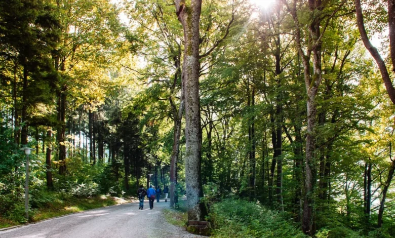
Urban centers across Europe are increasingly defined not only by their architectural density and economic output, but also by their immediate, seamless proximity to protected wilderness and extensive trail networks. Recent shifts in municipal planning and regional conservation efforts have prioritized the preservation of green belts, national parks, and ancient footpaths directly adjacent to major capitals. For travelers and residents alike, this convergence of metropolitan infrastructure and rugged topography offers a unique opportunity: the ability to transition from a subway platform or a historical city square to high-altitude ridges, dense pine forests, and coastal paths in a matter of minutes.
Urban planners note that the integration of multi-use trails on the peripheries of major European cities serves critical ecological, public health, and tourism functions. These pathways act as green lungs for densely populated areas while alleviating tourism pressures within historic city centers by dispersing visitors into regional parks. Below is a comprehensive examination of nine premier hiking trails located within minutes of Europe’s most prominent capitals, highlighting their logistical frameworks, historical significance, and geographical profiles.
Sörmlandsleden: Stockholm, Sweden
Stretching across more than 600 miles of diverse terrain, the Sörmland Trail (Sörmlandsleden) represents one of Northern Europe’s most extensive and accessible wilderness networks. Its integration with Stockholm’s public transit grid is a masterclass in urban-wildland connectivity; hikers can step off a commuter train at the Björkhagen metro station and immediately access the trailhead.
Geography and Logistics
The full trail network is divided into approximately 100 individual sections, ranging from one to 13 miles in length, catering to both casual day-hikers and long-distance backpackers. As the path extends outward from the capital, it navigates through protected forest valleys, rocky outcrops, and freshwater lakes. These aquatic habitats serve as critical staging grounds for migratory bird species, making the region a prime destination for ornithologists and nature enthusiasts. While basic wooden shelters are maintained along certain segments of the trail, regional authorities recommend traditional wilderness camping for overnight excursions, encouraging a low-impact approach to outdoor recreation under the Nordic right to roam (Allemansrätten).
Planet Trail: Zurich, Switzerland
For visitors seeking an educational and visually striking excursion without the physiological demands of alpine mountaineering, the Planet Trail (Planetenweg) on the outskirts of Zurich offers a precisely scaled model of our solar system.
Educational Infrastructure and Design
Running between the Uetliberg mountain and the Felsenegg vantage point, this two-hour interpretive walk scales the cosmos to terrestrial proportions. Every single meter of the path represents one million kilometers of actual space, translating roughly to one foot for every 200,000 miles. Hikers encounter three-dimensional, metallic models of all eight planets, culminating in a marker for Pluto. The route provides sweeping panoramic views over Lake Zurich and the surrounding Swiss Plateau. Because the elevation gain is minimal, civil engineers and tourism boards have optimized the route for family accessibility, merging physical activity with interactive scientific education.
Arthur’s Seat: Edinburgh, Scotland
Rising 823 feet above Holyrood Park, Arthur’s Seat dominates the Edinburgh skyline, offering an unobstructed vista of the Scottish capital’s medieval closes and neoclassical architecture.
Volcanic History and Archaeological Significance
Geologically, Arthur’s Seat is the main remnant of an extinct volcano system that erupted approximately 350 million years ago during the Carboniferous period. Human history is deeply etched into the basalt slopes; the summit features the well-preserved remains of a 2,000-year-old hill fort, underscoring the strategic military value the vantage point held for ancient Caledonian tribes.
The ascent requires traversing steep, rocky terrain and exposed escarpments. To manage high volumes of both local residents and international tourists, park management maintains multiple routes of varying difficulty, including the heavily trafficked path traversing the Salisbury Crags. Conservationists regularly monitor foot traffic to mitigate soil erosion on the fragile volcanic soils.
Mount Parnitha: Athens, Greece
Situated approximately 30 minutes north of the historic center of Athens, Mount Parnitha stands as the highest mountain range in the immediate metropolitan basin, reaching an elevation of 4,613 feet.
Ecological Recovery and Mythological Heritage
Steeped in classical mythology as the dwelling place of the god Pan, Mount Parnitha is a protected national park encompassing dense fir and pine forests, intricate karst cave systems adorned with stalactites and stalagmites, and diverse endemic flora. The area also holds significant historical value, containing the ruins of ancient fortresses and Byzantine monuments.
Following a severe wildfire in 2007 that devastated significant portions of the mountain’s lower slopes, regional authorities and environmental groups initiated comprehensive reforestation and wildlife reintroduction programs. Today, the park’s 12 marked trails support robust populations of the endangered red deer (Cervus elaphus). Hikers can utilize two prominent mountain refuges—Bafi and Flambouri—which provide overnight lodging and nutritional rest stops for endurance athletes and recreational walkers alike.
Dublin Mountains Way: Dublin, Ireland
Spanning approximately 25 miles from the suburban coastal neighborhood of Shankill to the western sprawl of Tallaght, the Dublin Mountains Way links the Irish capital’s eastern periphery to its rugged southern uplands.
Trail Segmentation and Urban Integration
Designed to be completed in its entirety over a 12-hour period, the route is officially divided into three manageable sub-sections: Shankill to Three Rock Mountain, Three Rock to the Hell Fire Club, and the final push from the Hell Fire Club to Tallaght.
The trail system incorporates forest service roads, open moorland, and historic boreen tracks. The highest point along the route, Fairy Castle on the summit of Two Rock Mountain, serves as a primary meteorological and navigational landmark, offering views across Dublin Bay and the Irish Sea. The trail’s development was spearheaded by the Dublin Mountains Partnership, a collaborative body established to balance recreational access with land stewardship and private landowner agreements.
Medvednica: Zagreb, Croatia
Rising immediately north of Croatia’s capital, Mount Medvednica is protected largely within the Medvednica Nature Park, encompassing an area of nearly 230 square kilometers.
Infrastructure and Industrial Heritage
The mountain is served by an extensive network of public transportation routes from downtown Zagreb, enabling car-free access for outdoor enthusiasts. Medvednica’s subterranean landscape features historical lead and silver mines, notably the Zrinski Mine, alongside natural karst caves.
Surface trails range from the gentle, densely wooded Leustek path to technical ascents leading to Sljeme, the peak elevation standing at 3,376 feet. Along these paths, historic stone churches, medieval fortresses such as Medvedgrad, and a network of mountain lodges operated by local hiking clubs offer traditional Croatian cuisine, functioning as vital social hubs for the regional mountaineering community.
Barlindåsen Ridge: Oslo, Norway
Norway’s capital is globally recognized for its integration with Enarka—the surrounding forest and wilderness areas that envelop the city. The Barlindåsen Ridge hike exemplifies this accessibility, offering high-reward panoramic views with moderate physical exertion.
Seasonal Dynamics and Public Access
Beginning near the Sandermosen train station, located 30 minutes north of central Oslo, the 3.5-mile loop trail ascends through mixed coniferous forest to a granite ridge overlooking the Maridalen watershed, which supplies much of the city’s drinking water.
Peak utilization occurs between May and October. During the mid-summer months, the trail corridors experience high yields of wild blueberries (Vaccinium myrtillus) and lingonberries, a traditional foraging resource protected under Norway’s public right of access laws. Environmental monitors note that the trail’s well-drained granite base minimizes mud accumulation, protecting the local watershed from accelerated erosion.
Goetheweg: Innsbruck, Austria
Innsbruck offers perhaps the most dramatic urban-to-alpine transit connection in Europe. Via the Nordkettenbahn cable car system, passengers travel from the historic Altstadt (Old Town) to Hafelekarspitze at 7,657 feet in approximately 20 minutes.
Technical Demographics and Alpine Engineering
From the upper terminal, the Goetheweg ridge trail cuts eastward along the dramatic precipices of the Karwendel range, offering views into the Inn Valley. The route descends through high-alpine meadows to Arzler Alm, a historic mountain chalet serving regional Tyrolean products, before winding back into the urban fabric of Innsbruck.
Spanning roughly six miles with a vertical descent exceeding 5,000 feet, the trail places significant mechanical stress on descending hikers. Local mountain rescue services and tourism boards frequently issue advisories encouraging the use of trekking poles to mitigate knee joint strain and prevent slip-and-fall incidents on the exposed limestone terrain.
Peninha Trail: Lisbon, Portugal
Rising directly out of the Atlantic mogs on the western edge of the Iberian Peninsula, the forested hills of Sintra host a trail network that blends natural topography with romanticist architecture.
Coastal Microclimates and Infrastructure Maintenance
Accessible via a 40-minute train ride from downtown Lisbon, trails originating at the Sintra railway station ascend through the Sintra-Cascais Natural Park. The route passes the defensive stone walls of the eighth-century Moorish Castle and the brightly colored nineteenth-century Pena Palace before summiting Cruz Alta at 1,542 feet.
Continuing westward, the path terminates near Cabo da Roca, the westernmost extremity of continental Europe. Due to the Atlantic convergence zone, the local microclimate frequently generates heavy coastal fog and sudden precipitation, requiring hikers to carry waterproof gear and sturdy footwear to navigate the steep, stone-paved historical tracks safely.